PRISM-19
Project Archive
The overall
objective of PRISM is to develop algorithms and techniques to
demonstrate that the top ~15cm layer of soil moisture can be
remotely sensed using a new state-of-art P-band radiometer
capability. Timely soil moisture information on this near-surface
layer is critical to improve water management for food production
in the face of extreme climate variability. Current satellite
technologies are limited to the top ~5cm layer of soil using an
L-band radiometer.
The PRISM
airborne campaigns involve collecting airborne P-band data
together with L-band and/or K-band data, with concurrent ground
observations of soil moisture and ancillary data for a diverse
range of conditions. The campaigns will be conducted in the Yanco
area, with the aims to:
Aircraft instruments are typically installed in an underbelly pod or in the wingtips of this aircraft. Aircraft navigation for science is undertaken using a GPS driven 3-axis autopilot together with a cockpit computer display that shows aircraft position relative to planned flight lines using the OziExplorer software. The aircraft also has an OXTS (Oxford Technical Solutions) Inertial plus GPS system (two along-track antennae on the fuselage) for position (georeferencing) and attitude (pitch, roll and heading) interpretation of the data. When combined with measurements from a base station, the RT3003 can give a positional accuracy of 2 cm, roll and pitch accuracy of 0.03° and heading accuracy of 0.1°.
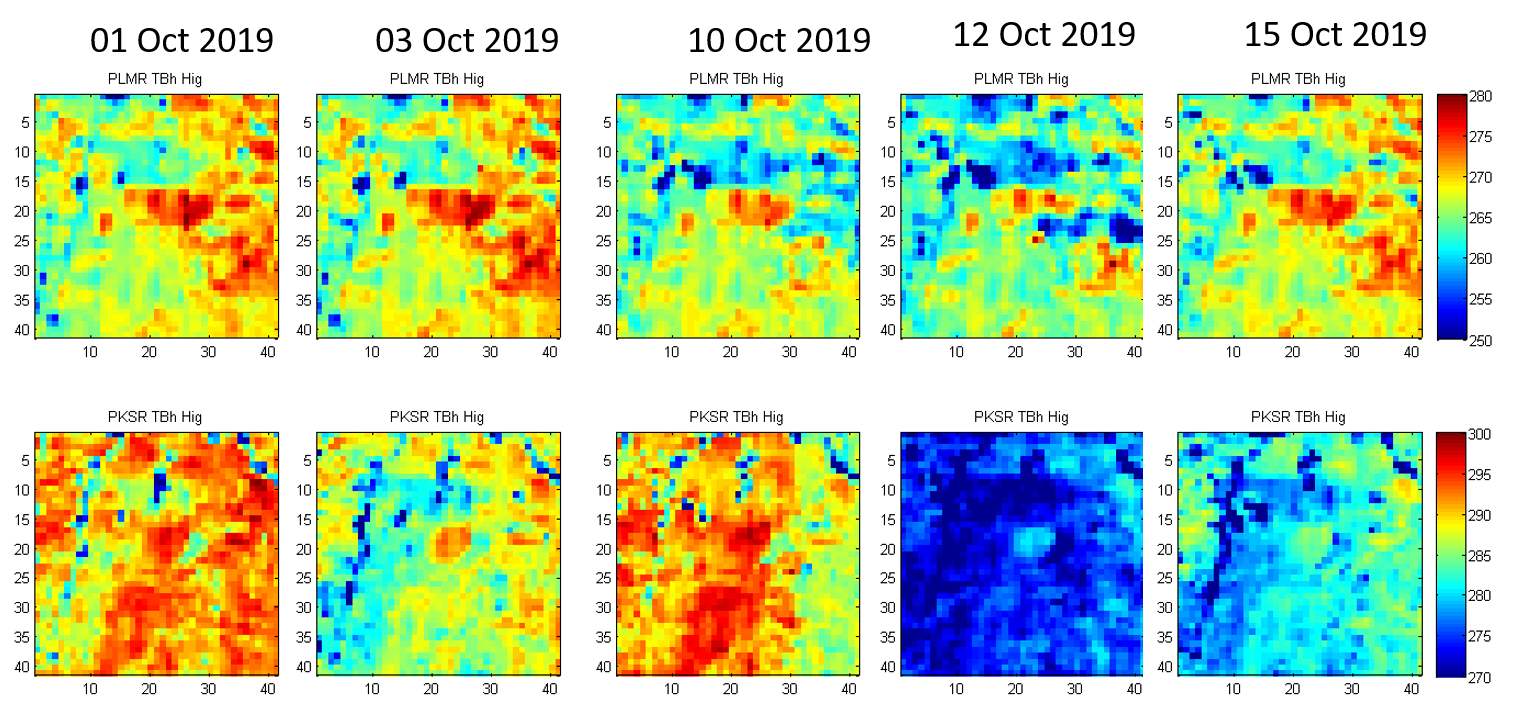
DS flight: High altitude PLMR_TBh & PKSR_TBh.

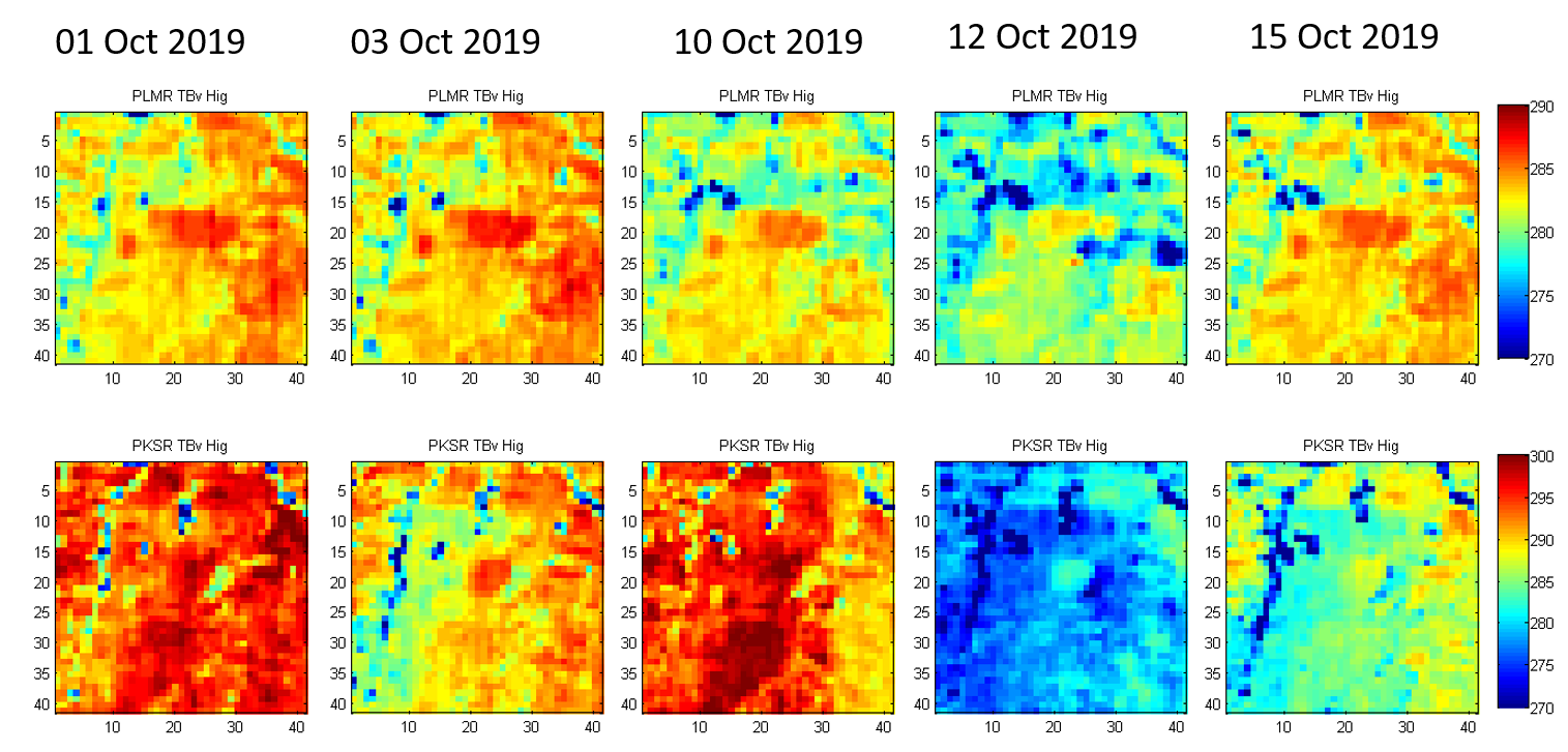
DS flight: High altitude PLMR_TBv & PKSR_TBv.

Created: June 2021 Last Modified: June 2021
Maintainer: Xiaoling Wu, xiaoling.wu@monash.edu; Luisa White, luisa.whitemurillo@monash.edu